Skip to content
Save Silver Creek

Save Silver Creek Data Site

MENUMENU
  • External Data Links
    • IDWR
    • IDF&G Silver Creek Reports
    • Historical Palmer Drought Indices
    • IDWR Groundwater Mapping
    • County Water Info. Map
    • USGS Silver Creek Flows
  • SSC Data
    • Save Silver Creek Data Page
    • Written Documents and Studies
    • Data Charts and Tables
    • Silver Creek Tributary Flow Chart
    • Water Information Page
  • Earth KML Files
    • Full Data KML File
    • 1946 Map
    • Thermal Map
    • Temperature Data Map
    • Sediment Data Map
    • Dissolved Oxygen Data Map
    • Restoration Areas
  • Silver Creek Reports
    • 2010 Watershed Report
    • 2020 Silver Creek Assessment
    • 2011 Annual Report
    • 2012 Annual Report
    • 2013 Annual Report
    • 2014 Annual Report
    • 2015 Annual Report
    • 2016 Annual Report
    • 2017 Annual Report
    • 2018 Annual Report
    • 2019 Annual Report
    • 2020 Annual Report
    • 2021 Annual Report
    • 2022 Annual Report
    • 2023 Annual Report
    • 2024 Annual Report
  • SSC Imagery
    • Silver Creek Thermal
    • 1946 Historical

#4 Sediment Mud Creek

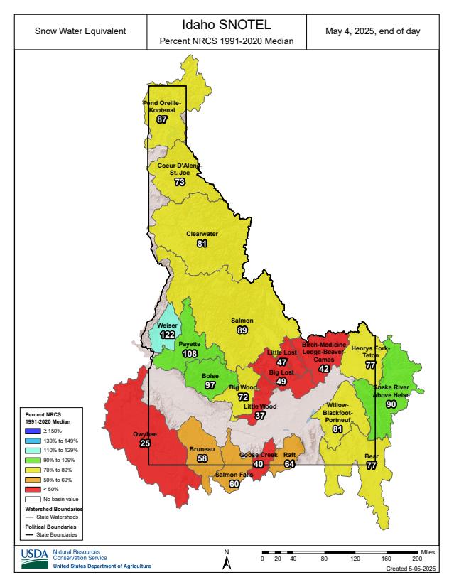
Master Data List / Sediment Location Map

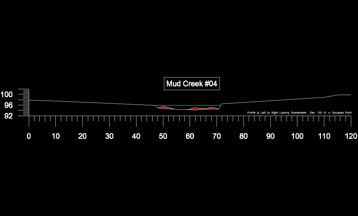
Silt Cross Section #4
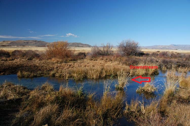
Mud Creek

Silt x-section data looking downstream left to right.
1st x-section date: 11/2011

Hover over Image to enlarge / Print Image

Donate to an Amazing Silver Creek Project!

Water Page

2024 Silver Creek Annual Report

Silver Creek Data Page

Written Documents and Studies

Tables and Charts

SSC Imagery: Historical / Thermal

How Does Silver Creek Work?

BWRGWMA Groundwater Management Plan (through 12/31/2027)

New! Silver Creek Interactive Stream Temperature Prediction Tool.

Current Silver Creek Flows: 05/5/2025-131cfs / 2024 (same date)-120cfs

Season 2024-2025 SNOTEL

Percent of  30 year Average

Season-to-Date Precipitation: 95

Snow/Water Equivalent: 72

  • Contact
  • How You Can Help
  • Privacy
  • Terms